26 April 2017

Hebden Bridge: Hip operations

Hippy life in Yorkshire? I can promise you, having grown up through them, that the Swinging Sixties barely even wobbled in Hull, never mind swung. All that love, peace and alternative living may have gone on in the decadent south but it never made it north of Sheffield. So it's a pleasant surprise to come to Hebden Bridge, Yorkshire's Hippy Capital.


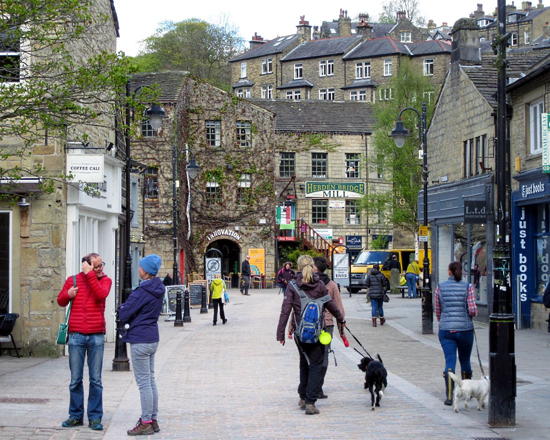
The market town (pic) has a population of under 5,000 but, like the blister caused by my cheap bike shoes, feels bigger than it is. And taller: stacked up on the Calder valley's steep hillsides are double-decker houses with the top stories facing the hill and comprising one dwelling, and the bottom stories facing the valley and comprising another.


It's an alternative sort of place, tolerant and gay-friendly: the Lesbian Capital of England, it's often called. It's certainly got an alternative-lifestyle feel, as a glance at a typical coffee shop noticeboard shows (pic). If you're after Reiki, Holistic Massage, Existential Therapy or Energy Medicine, you're spoilt for choice. And while you make your mind up, the cafe offers 19 sorts of cake and 15 types of herbal tea.

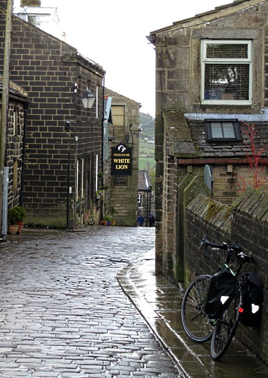
The town started off as Heptonstall, a broodily characterful village (pic) a short cycle away.

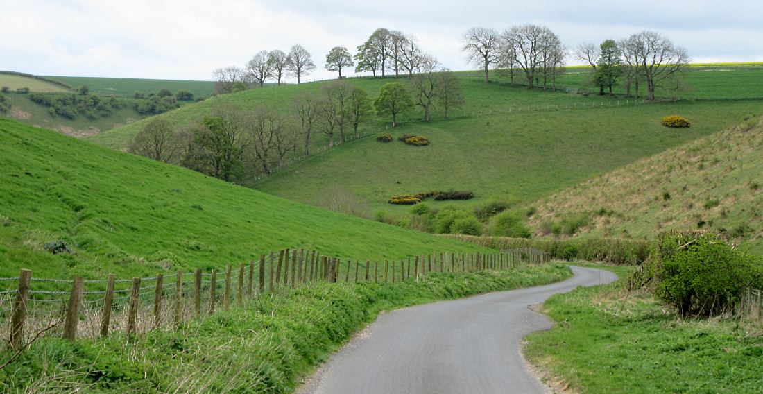
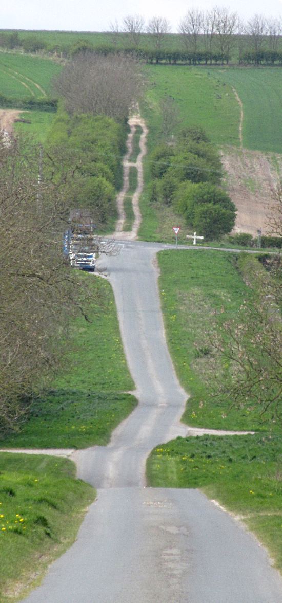
If you're coming downhill into Hebden Bridge, anyway. Because, like any road that doesn't actually run along the valley floor parallel with the railway or canal, it's very very steep.

And cobbled, like many lanes around here. Forget Paris-Roubaix: you can test the security of your fillings by cycling down Heptonstall main street.

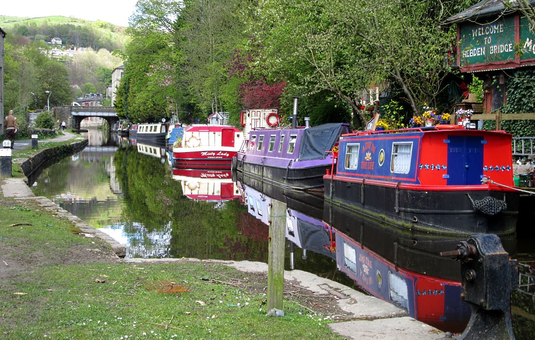
Until the 1800s, there was no road along the valley floor. But as the industrial revolution revolved, the canal (pic) and railway came through the valley, Hebden Bridge grew around the river crossing, and textile mills thrived. It became known as Trouser Town; not any more, now that the mills are long closed and converted to chic apartments. It's no longer a place defined by images of patriarchal legwear. More like jams, either of the preserve or musical kind.

There's a strong community feel, as the town's local website demonstrates. It has a fair few meeja types who live here in those chichi lofts, commute to Manchester or Leeds by the slow but frequent trains, and enjoy organic gluten-free artisan local bread in Hebden Bridge's chic cafes and bistros.

But, also, many people don't have Monday-to-Friday, 9-to-5 jobs. Or any clear job at all. (Perhaps the people who live on the colourful narrowboats moored all along the canal.) So I feel I have a lot in common with them.

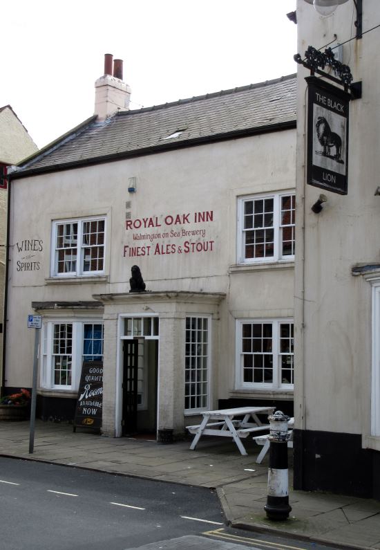
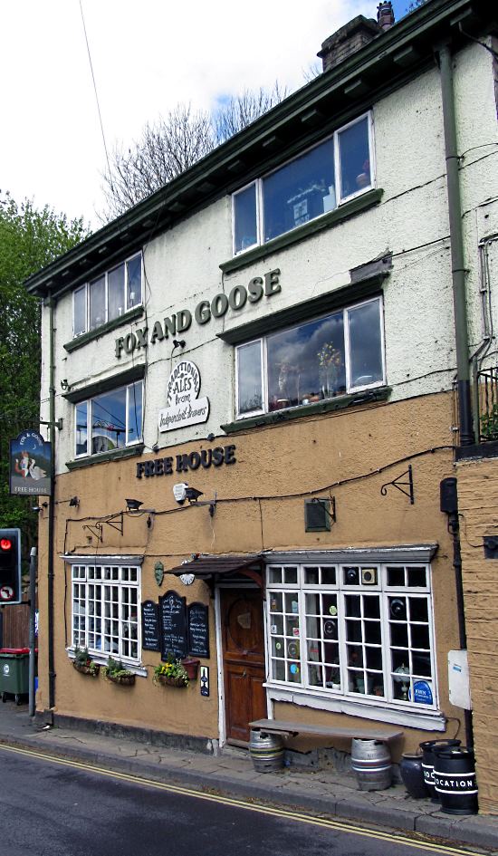
For all those people, there are plenty of events to fill the afternoons in bookshops or art studios or community-owned facilities such as the Fox and Goose pub (pic).

Scruffy in appearance, it's actually friendly and well-organised, with fine local real ale always close at hand. So I feel I have a lot in common with it, too.

21 April 2017

E: York to Bridlington

The third of my Yorkshire Compass Rides was a wind-assisted glide through the Wolds to seaside Bridlington, and the eastern promontory of Flamborough Head. It included the area's most scenic downhill, a Roman Road, a lighthouse-rich chalkberg, and a land train.


There's always something nice about returning home. Less so this morning, though, as I twice had to go back after setting off thanks to forgetting maps, water, locks, lunch etc.

The maps I could have forgone, but not the lunch: it's socially more acceptable to ask for directions than for food. But, by mid-morning, I was being airlifted by the tailwind up into the Wolds from Leavening, with the hardier of the daffs still painting the morning yellow (pic).


The freewheel down Water Lane's winding dry valley into Thixendale is one of my favourite rides in Yorkshire (pic). It's worth stopping occasionally to enjoy the solitude, admire the fields full of perky lambs, and evade the bladed tractor trailers that speed past occupying the entire single-track road.

'There's always a bike', it's said. The always-bike was here (pic) on the information boards in my Second Breakfast stop in Thixendale village. This is farmer William Sedman chuffed with his new bike circa 1890.

He'd have known only rough farm tracks and potholed, crudely-surfaced – but virtually untrafficked – country lanes, so he'd be amazed to see what cycling is like here today. It's exactly the same.
My approach to Bridlington was along the old Roman Road that linked the town right through to York (pic). It's still possible to trace, even ride, the old road all the way: by turns it is the A166, overgrown footpaths, tractorways and single-lane tarmac back lanes.

Miserable old poet AE Housman moaned on about standing in dead Romans' footsteps like this in his lament On Wenlock Edge.

Come on, AE, cheer up lad! Yes, Brexit, Trump, climate change, we're all going to die, blah blah. But the wind's behind us, it's a bright breezy day, we're on our bikes in friendly scenery in the best county in the world, and the sign outside Sledmere House's cafe promises us ICE CREAM – VENISON – RHUBARB.
Anyway, in Brid (locals truncate place names by eliding all suffixes: 'Brid', 'Pock', 'Driff' etc) they're gearing up for the Tour de Yorkshire's arrival next week. In tribute, gaudily coloured bikes had been put high up on walls or up trees (pic). Or perhaps it's the only place you can stop them getting nicked.
Brid was the location for the filming of the recent Dad's Army remake. The Old Town – really one street that the Sustrans route helpfully takes you down – still has a few shops left in the period setting for it, most notably the Black Lion (pic), the 'Royal Oak' of the film.

Reviews of the film were unanimous in their high praise for the fine script, superb acting and rich humour of the original.
Flamborough Head isn't the easternmost point in Yorkshire – that's further south, on Spurn Head – but it's locally the furthest out into the North Sea.

It certainly feels like a place on the edge, with its two lighthouses that are like chalk and cheese. This one (pic) is made of chalk...
...and this one (pic) is made of brick. The chalk one was built in 1669, and was never lit.

Perhaps it failed because unlike this modern one, it did not have a café-bistro serving fish and chips and lager to friendly, busy crowds of locals.

This is Flamborough Head itself (pic), a chalky rival to the Isle of Wight's Needles, except it's Yorkshire which means it's harder, brighter and better-looking.


I toiled back west to Bridlington into the wind. There were no cycle spaces on the Land Train (renationalise the rail system NOW) so I enjoyed a sunny cycle into town along the lovely promenade (pic; that's Flamborough Head in the background). The prom also is the endpoint of the Way of the Roses, which runs 170 miles to Morecambe. With today's wind, you could have done the ride from the west coast in a day.

I used to say Bridlington is a place that grows on you, like athlete's foot. But actually, you know, I'm rather taking to the place. It was lively, full of people, and on this blowy but bright day was a very pleasant place to be. Not St Tropez, admittedly – where is? – but it was a nice reminder that Yorkshire has that bit of everything.

Then I enjoyed a sunny cycle to Wetherspoons. I wondered if it had been a location for the Dad's Army film too, because to judge by the taste, my pint of Riggwelter had a drink-by date of summer 1944.

Miles from York to Flamborough Head: 53

04 April 2017

S: York to Harthill

The second of my Yorkshire Compass Rides took me south to the county's most obscure extremity, and was a day of planets, power stations, pints, and a place called Wales.

I rode south alongside a mirror-flat Ouse out of York and down the planets trail, a fantastic scale model of the solar system where the speed of light is roughly 1mph. The planets had evidently just had a lick of paint, so Earth was a blue marble, Mars was cherry red, Uranus (pic) duck egg blue. (NB Actual planets' colours may differ.)

Riding this path is a great way to get a feeling for the sheer emptiness of space, and these remote extraordinary worlds very different from our own. Selby, for instance.


I only have space for one picture from Selby, so sadly images of the Rank Hovis plant, derelict factories and disused warehouses had to make way for the Abbey (pic).


South of Selby the landscape consists largely of power stations, such as the thicket of cooling towers at Eggborough (pic). Here traditional crafts, dying out elsewhere, are still practised, such as coal fired electricity generation.


I continued south-ish through a series of nondescript villages and humdrum flat farmlands to Adwick le Street, where there's a rather handy paved cycle path called Roman Ridge. This took me past some wild and savage landscapes, all of them back gardens in Adwick. The sign is a bit of an exaggeration, to be honest: it's not exactly Striding Edge. Similarly, Don Gorge, signed further down, is no Cheddar. Another sign that promised more than it delivered was in the cafe in Maltby promising a 'luxury breakfast'.


The southernmost point in historic Yorkshire that you can cycle is this rather inconsequential location (pic, looking south). It's at a stream by Pebley Pond, south of Harthill, helpfully colour-coded in the tarmac. (Post-1974 South Yorkshire stretches further south than this, having stolen bits of Derbyshire.)

To get the train home I had to go to Wales (pic). It's a village outside Rotherham. The name derives in the same way as the country, meaning literally 'land of closed coal mines and disused steelworks'.

I had a pint of Sam Smith's for two quid in Kiveton, then a pint of Yorkshire Blackout in the Tap in Sheffield train station to take the taste away.

Miles from York to Harthill: 57

03 April 2017

N: York to Redcar

The first of my Yorkshire Compass Rides was a glorious day offering some characteristic Yorkshire views – stately homes; the North York Moors; beaches with hardy bathers; closed factories; and penguins.


I headed north out of York through the misty Howardian Hills (pic). They take their name from the Howard family, who still own much of the land. This is officially designated an Area of Outstanding Natural Swearing by Cyclists.

In the village of Bulmer I stopped off at one of those old red phone boxes that now serve as a library (pic). Many books caught my eye but I read through the best bits of a book by famous renowned 5' 9" author Dan Brown.

That way I only delayed myself by a couple of seconds.


The Howards did quite well for themselves, building Castle Howard, one of England's greatest country houses. And film sets: it's been used in Brideshead Revisited among others. There's something about big budget productions that's appropriate here, such as when you see the price of an adult entry. Still, at least cycling along the remarkably gated and obelisked road to the west (pic) is free.


After handsome Kirkbymoorside, a place that seemed to consist entirely of pubs and cafes, I rode up into the Moors through Hutton le Hole (pic) and its quirky, sprawling green. It's one of my favourite Moors villages, and is home to the Ryedale Folk Museum, where you can go inside historic old buildings and see how ordinary poor people used to live. Alternatively, you could just come to my home in York and stay with me for a weekend.


This is the characteristic North York Moor-top road view, across Blakey Ridge. I stopped off at the fabulous Lion Inn, one of England's highest and remotest. It was packed with lunching couples, and is a great place to come on a budget. If your budget is £20 for a main course.


Hill? Call this a hill? In Yorkshire this is a slope.


My northward line brought me to the coast at Saltburn. The pier has been refurbed, the prom given a lick of paint, and on this sunny afternoon the beach, cafes and bars were humming. It was very pleasant, and I found it hard to leave, though that was mainly because the Sustrans route out was closed with electricity works, and the only alternative was to ride along the dual carriageway horribly busy with HGVs.


Redcar isn't quite the most northerly point in Yorkshire – that's over to the north-west at Cauldron Snout – but my northerly line from York finished here, at the mouth of the Tees. Redcar's prom is jauntily decorated with these penguins, and there's a boating lake.

The background illustrates Yorkshire's industrial past, and – recent awful closure of the steelworks here notwithstanding – present: from here west to Middlesbrough is one long line of factories, and just out to sea is a line of graceful wind turbines. I celebrated finishing my first Yorkshire Compass Ride with a beer in Wetherspoons, down past the clock tower. Which was handy: ah, I can see, just time for another.

And finally, the train back home. Someone had been busy yarnbombing the station. This could be the fate of the steelworks one day.

Miles from York to Redcar: 63